Asset Rental Management
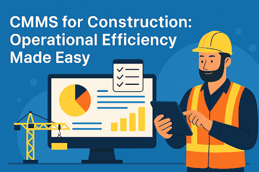
Construction
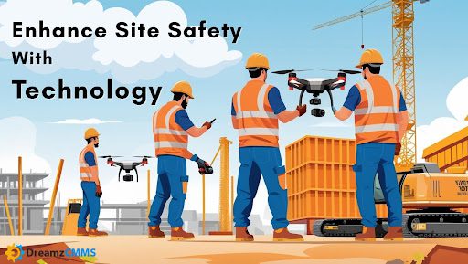
Drone Site Tracking: Enhancing Visibility, Safety, and Project Precision from Above
- June 25, 2025
- DreamzCMMS Team
- 7 minutes read
- June 25, 2025
- DreamzCMMS Team
- 7 minutes read
Why Aerial Visibility Is Becoming a Leadership Priority
Project timelines are tighter. Risks are higher. Expectations from clients and stakeholders continue to grow. In this environment, waiting days or even hours for updates is no longer acceptable.
This is why drone site tracking is gaining traction across industries like construction, infrastructure, and energy. It offers something project managers and executives have long needed: a high-level view, delivered in real time.
With aerial site monitoring with drones, teams can observe entire project areas at once without having to be on the ground. This reduces delays in decision-making and creates a clearer picture of progress, safety, and coordination.
But it goes beyond visibility. These tools also support drone-based progress monitoring, where footage and site maps become data-rich records that guide reporting and planning.
Integrated platforms like Construction Project Management Software turn these visuals into actionable insights. Drone footage links directly to project timelines, milestones, and safety plans making site intelligence part of everyday workflows.
What used to take a full walkthrough and a stack of reports can now be accessed with a few clicks.
Real-Time Data, Real-Time Decisions
In high-stakes projects, timing matters. The sooner leaders see what is happening on-site, the faster they can respond to problems, adjust resources, or shift priorities. That is the value of real-time project tracking via drones.
Unlike traditional inspections or static reporting, drones provide live data feeds and visual updates from multiple angles. Executives no longer need to wait for filtered summaries; they can view work as it happens.
Automated site mapping with drones takes this one step further. Drones fly predefined paths to capture images, generate maps, and deliver 3D models all without human intervention. These maps are not just pictures. They are high-accuracy layers that show site layout, material use, and terrain conditions.
This data becomes a decision-making tool, not just a record. When mapped against schedules and budgets, it helps teams track productivity and spot inefficiencies early.
Solutions like Facility Management Software and integrated dashboards allow stakeholders to overlay drone imagery with task assignments, equipment status, and safety zones giving everyone a full picture of progress in one place.
The result is better planning, fewer delays, and faster execution. When everyone sees the same reality, alignment becomes natural and momentum builds.
A New Perspective on Safety From Above
Worksites are dynamic, and safety conditions change fast. Heavy equipment moves, crews shift positions, and risks emerge without warning. For leadership, keeping up with it all requires more than static checklists; it demands constant visibility.
That is where drone site tracking earns its place. With drones flying overhead, project leaders gain real-time views of high-risk zones without sending staff into harm’s way.
These aerial tools support site safety monitoring using drones, helping teams spot issues like missing barriers, congested equipment zones, or unsafe material storage. And because the footage is clear and immediate, action can follow quickly.
Large facilities and multi-level projects often call for special inspections. Traditionally, that might mean scaffolding, shutdowns, or delays. But now, drone inspections for large sites cover those same areas in minutes. They reduce exposure, speed up inspections, and deliver consistent visual data.
Drones also build a record over time. Teams can look back at footage, monitor site changes, or provide timestamped proof during reviews. That becomes especially valuable when meeting regulatory standards or handling incident investigations.
Solutions like Field Service Management Software make it easy to pair drone visuals with maintenance logs, asset conditions, and safety reports all in one dashboard. No more disconnected data. No more guesswork.
Safety improves when visibility increases. Drones make that visibility continuous.
Bring Precision to Your Project OversightLooking to reduce guesswork and improve site visibility?Explore how DreamzCMMS integrates drone site tracking with real-time project data, safety monitoring, and asset performance insights all from a unified platform. Book a Free Demo today to see it in action. |
Drone-Integrated Project Management: A Strategic Advantage
C-suite decision-makers are no longer looking for raw data; they want context, patterns, and answers. Drones do not just provide imagery. When paired with intelligent systems, they become instruments of insight.
Modern platforms make it possible to align drone footage for construction updates with your actual progress timelines. Whether tracking equipment movement, workforce distribution, or daily task completion, executives can now validate plans with aerial facts.
This integration becomes even more powerful with drone-integrated project management. Visual data is matched with milestones, cost forecasts, and safety records all updated automatically. The result is not just oversight, it is operational clarity.
Leaders can view drone-based progress monitoring visuals alongside Gantt charts, labor reports, or maintenance status all in one place. This eliminates silos between departments and puts everyone on the same page.
Tools like DreamzCMMS take it further. They connect drone intelligence with modules for Asset Maintenance Management Software, Facility Management Software, and more. The goal is not just to track what is happening but to take the right action faster.
In fast-moving environments, that agility sets top performers apart.
Turning Drone Data into Strategic Advantage
Managing multiple project sites requires more than daily updates; it calls for continuous alignment between operations and executive priorities. That is where drone site tracking changes the game.
With a steady stream of aerial visuals, leadership teams gain more than just images. They gain insight. These visuals offer proof of progress, uncover delays, and verify resource allocation all without stepping on-site.
The value of aerial surveillance for project sites lies in its ability to bridge what is planned and what is real. This allows stakeholders to move beyond assumptions and act with certainty.
Executives can use drone-captured maps to review vendor performance, validate timelines, and ensure capital is being deployed as intended. Whether the focus is construction, utilities, or infrastructure, visibility leads to stronger outcomes.
When integrated with tools like Asset Maintenance Management Software, drone footage also helps reduce equipment downtime by feeding into preventive routines and asset planning strategies.
For project-heavy organizations, drones are no longer an add-on. They are a force multiplier. And when insights from the field match the expectations in the boardroom, that is when strategy becomes execution.
Conclusion: Drone Data Is Business Intelligence
Drone technology is no longer just about capturing impressive visuals. It has become a core part of construction site drone tracking, offering data that drives smarter operations, quicker decisions, and tighter project controls.
From automated site mapping with drones to aerial surveillance for project sites, executives now have tools that go beyond reporting; they empower prevention, foresight, and cost control.
What was once difficult to measure site efficiency, crew alignment, and safety conditions can now be tracked from the sky with near-instant accuracy.
When paired with a platform like DreamzCMMS, drone insights become even more powerful. They support everything from Asset Rental Management Software to Field Service Management Software, creating a single source of truth across your project ecosystem.
Explore More on Smart Construction PracticesFor deeper insights into improving coordination, documentation, and on-time delivery in construction, consider the following reads:
|
See Your Projects from a Higher PerspectiveLooking to improve site visibility, reduce delays, and strengthen safety oversight?With DreamzCMMS, you gain more than just drone footage; you gain actionable insights connected to your entire project lifecycle. Schedule Your Free Demo and discover how aerial tracking, automation, and data-driven planning come together to help you lead with confidence. |


Subscribe to Our Newsletter
 100% SECURE
 We Respect Your Privacy
 Ready for More?
Talk to one of our CMMS experts and see how DreamzCMMS can simplify your maintenance operations.
Book a free consultation